Reasons to Object
The applicant submitted new documents in February 2025. The deadline for comments/objections has been updated to 12th April 2026. However, all objections submitted after that date will still be considered up until the decision date (as yet unknown). Even if you have already submitted an objection, it is important that you do so again based on the revised planning documents.
In the opening statement of the DHL appeal relating to the AL2 development (DHL warehouses at Towcester), Saira Kabir (representing WNC) stated 'it is also telling that this proposal has attracted over 1000 objections. This is not a matter to be lightly dismissed. It is a further barometer of the objectional nature of this scheme. The proposal will have harmful consequences for those in this community who will have to bear the impacts on a day to day basis' .
Although the number of objections cannot determine an outcome, a high number of objections will make the deciding planning committee members take notice.
Full details of the planning application and supporting documents can be found on the link below. (You'll need to register to comment, which takes only 30 seconds):
Or you can email to planning@westnorthants.gov.uk
or write to: Planning Department, West Northampton Council, The Guildhall, St Giles Square, Northampton, NN1 1DE
Always include the Planning Reference Number WNS/2022/1741/EIA
Below is a summary of the many reasons to object to this unsuitable development. Click on each title for more detailed info.
A large number of documents were uploaded to the planning portal in February 2025, a summary of which can be found via the link directly below. (However, your comments to the council should still include any of the reasons in the main section below that you're concerned about, even if you have written previously):


“Ensuring that new development is focussed in sustainable settlements whilst protecting the overall rural character of the area and including the tranquillity of areas which have remained relatively undisturbed by noise and are prized for their recreational and amenity value.”
West Northants Council Local Plan Part 1
- The scheme is contrary to the Council’s development plan in material respects. It causes significant landscape and visual harm and takes an unreal and flawed approach to the impact of the proposal on the highway network
- Unit 1 is oversized and designed in a way that is not in accordance with the parameters in the SPD, with consequential harm to the local environment
- The Development fails to deliver the principal policy objective of AL5 to provide a variety of employment opportunities on the Site to reflect the need for diversity and resilience in the local economy, as expressed in the Council’s economic growth strategy
- The road infrastructure is not designed in accordance with the policy criteria in 4(a) to provide a new roundabout junction from the A508.
- There are serious questions about the deliverability of new public transport links to the Site to provide sustainable transport.
- FlPedestrian/Cycle Connectivity: The required connection to Old Stratford is not demonstrated as deliverable. Key sections lie on National Highways and Parish Council land with no agreements in place, contrary to AL5’s requirement for safe, direct, and deliverable sustainable access.
- Heritage Setting: The scheme fails to respect the setting of nearby heritage assets, including the setting of the Grand Union Canal Conservation Area, contrary to the SPD and Local Plan design policies. Does not maintain the identity of towns/villages; risks coalescence of Old Stratford and Cosgrove. SS2:
- Ecology and Biodiversity: Key ecological surveys and assessments remain incomplete or disputed including inadequate mitigation; the scheme does not demonstrate compliance with required biodiversity net‑gain standards. Policy non-compliance: NPPF 187 & 193, NE4, NE5, HE6
- ‘Habitat of Principal Importance in section 41 of Natural Environment and Rural Communities Act (NERC 2006), loss of this habitat would conflict with South Northamptonshire Local Plan (Part 2) policy; Policy NE5 Biodiversity and Geodiversity’ (Paul Evans WNC Principal Natural Environment Officer)
- Traffic increases have been under-estimated - a review reveals that the proposed development could generate up to 93% more HGVs and 47% more light vehicles in the peak hours than has been assumed. Old Stratford roundabout is already 7% over capacity at peak periods.
- Poor accessibility by sustainable modes will lead to an increase in car trips. There is no current bus service and while one is proposed, it will only be subsidised for 2 years
- Not compliant with Local Plan AL5 - this requires a roundabout to be created for site access, which the proposal no longer includes.
- Junction proposal creates safety risk. Modelling shows delays of up to 2 minutes, creating safety risk from frustrated driver behaviour, who would pull out when unsafe to do so.
- A508 road requires widening by 2m to create a safe filter lane, and significant earthworks are required to level the junction, feasibility of which the applicant has failed to demonstrate.
- Wrong location - The site’s location is not consistent with the South East Midland Local Economic Partnership’s study that recommends locating major warehousing sites within 5km of high-quality strategic routes and with access to rail. This site is 15km from the M1 (junction 15).
- There is little or no consideration from the planners or the council regarding traffic generated by other allocations in the area and their impact on the development.
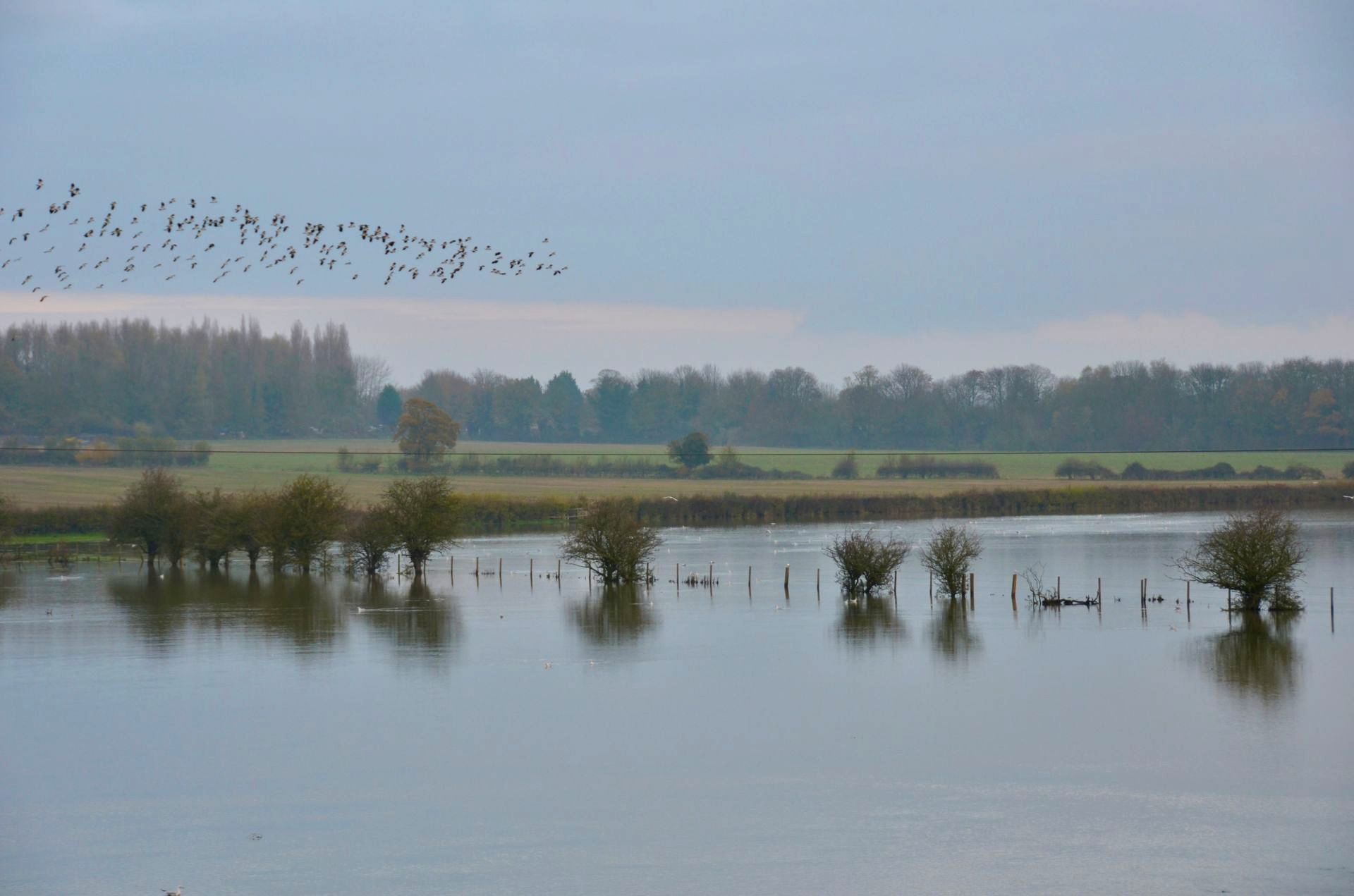
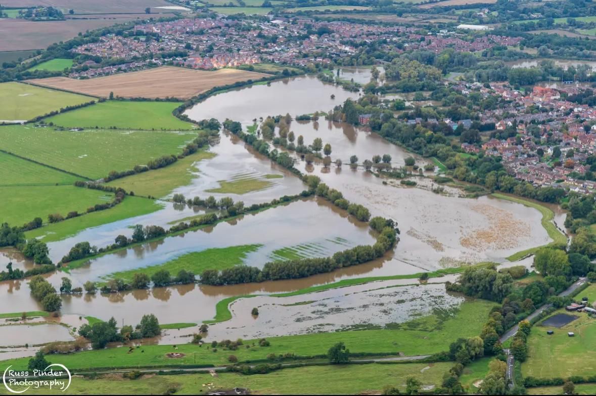
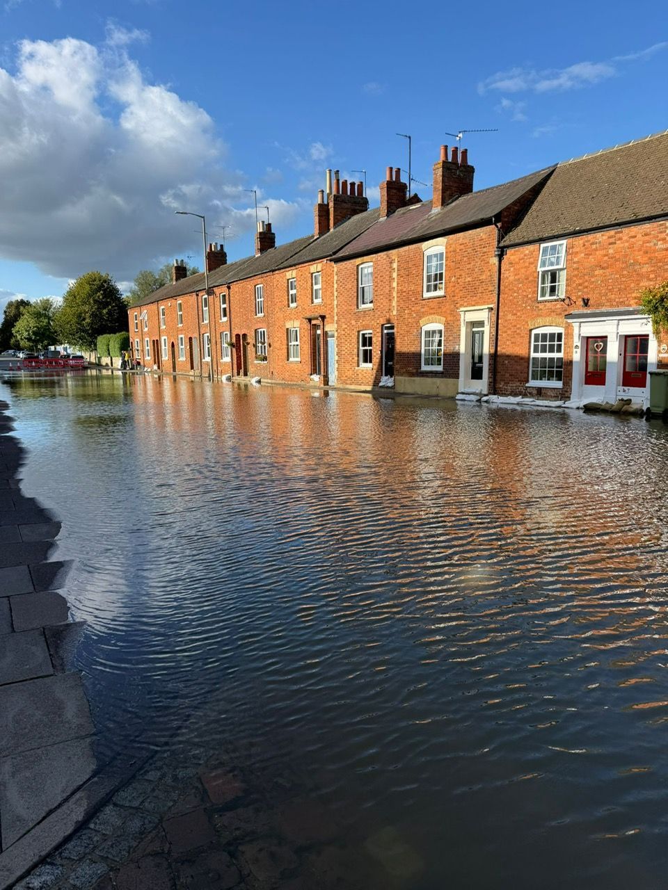
- Major loss of soakaway in a WNC Flood Zone, leading to the risk of increased flooding in Stony Stratford and downstream in Newport Pagnell
- Developers propose enlarging the culvert under the canal, disregarding the Environment Agency’s warning that this would worsen flooding risks by accelerating water flow to the Ouse
- The developer's plan to create a massive reservoir is a major engineering project and was not part of the original scheme. If it breaches, it could cause extensive flooding and potential loss of life
- The reservoir will be filled with effluent-rich water during periods of high rainfall. Logic dictates that if the outflow is slower than the inflow, the reservoir will fill up. In that case, where will the floodwater go?
- Any flood storage scheme will function as a reservoir, requiring ongoing regulation and maintenance by site owners. The ‘reservoir’ will still be an earth bund with “engineering fill.”
- Developers boldly claim the development will “reduce” flood likelihood. The EA still have concerns about this as do the LLFA who don’t believe it is a sustainable solution with respect to management of flood risk within and downstream of the site.
- Noise pollution: the developer is saying that it will cause a greater than 10db increase in noise, which will be noticeable to residents, impacting mental and physical health. WNC Environmental Protection say the development should aim for "no" impact rather than "low" impact
- Light pollution: both from permanent building lighting and from vehicle lighting will be a similar contributor to the poorer mental and physical well-being of residents and effects on wildlife in the Ouse Valley
- Air pollution: emissions from 3,000 HGV movements per day plus increased traffic from employees accessing the site
- Visual pollution: will be visible for miles
- No plan to deal with contamination in spite of previous planning refusal, other than the developer will stop proceedings if they discover contamination at a later date
- Proposed vehicle washing station on site could lead to further river contamination
- Construction impacts not properly described
- Destruction of Nationally Important Habitat: The site contains Open Mosaic Habitat (OMHPDL) a Section 41 Priority Habitat. All experts (WNC Ecology, Wildlife Trust, Buglife, Bioscan) confirm the developer has under‑valued it and that it cannot be recreated.
- Site qualifies as a Local Wildlife Site (LWS): Independent bodies confirm the site meets LWS criteria due to its rare species and Priority Habitat. Local policy requires LWS quality sites to be protected, not built over.
- Exceptional Wildlife at Risk: 565 invertebrate species, including 35 scarce or threatened and 6 Red Data Book species.Reptiles (Slow Worm, Grass Snake), rare plants (Aira praecox), and Vulnerable bees confirmed.
- Mitigation Hierarchy Ignored: Developer has skipped avoidance and gone straight to compensation. All consultees say this breaches national and local policy.
- Country Park “Compensation” Will Not Work: Soil too fertile to recreate OMHPDL, translocation likely to fail, specialist species will not survive the move. All experts (WNC Ecology, Wildlife Trust, Buglife, Bioscan) call the plan unachievable.
- The developer’s LVIA is unreliable and misleading
- Warehouses would dominate the rural valley, destroying countryside character
- Old Stratford and Cosgrove risk coalescence into one sprawl, breaching Policy SS2
- The Grand Union Canal Conservation Area would suffer visual harm from massing and lighting
- Landscaping promises are exaggerated; 18‑metre sheds cannot be screened effectively
- Night‑time lighting impacts are ignored, despite 24/7 operations
- The proposed country park does not offset harm and reduces floodplain openness
- The scheme fails Local Plan policies SS2, NE4, HE6, ALP5
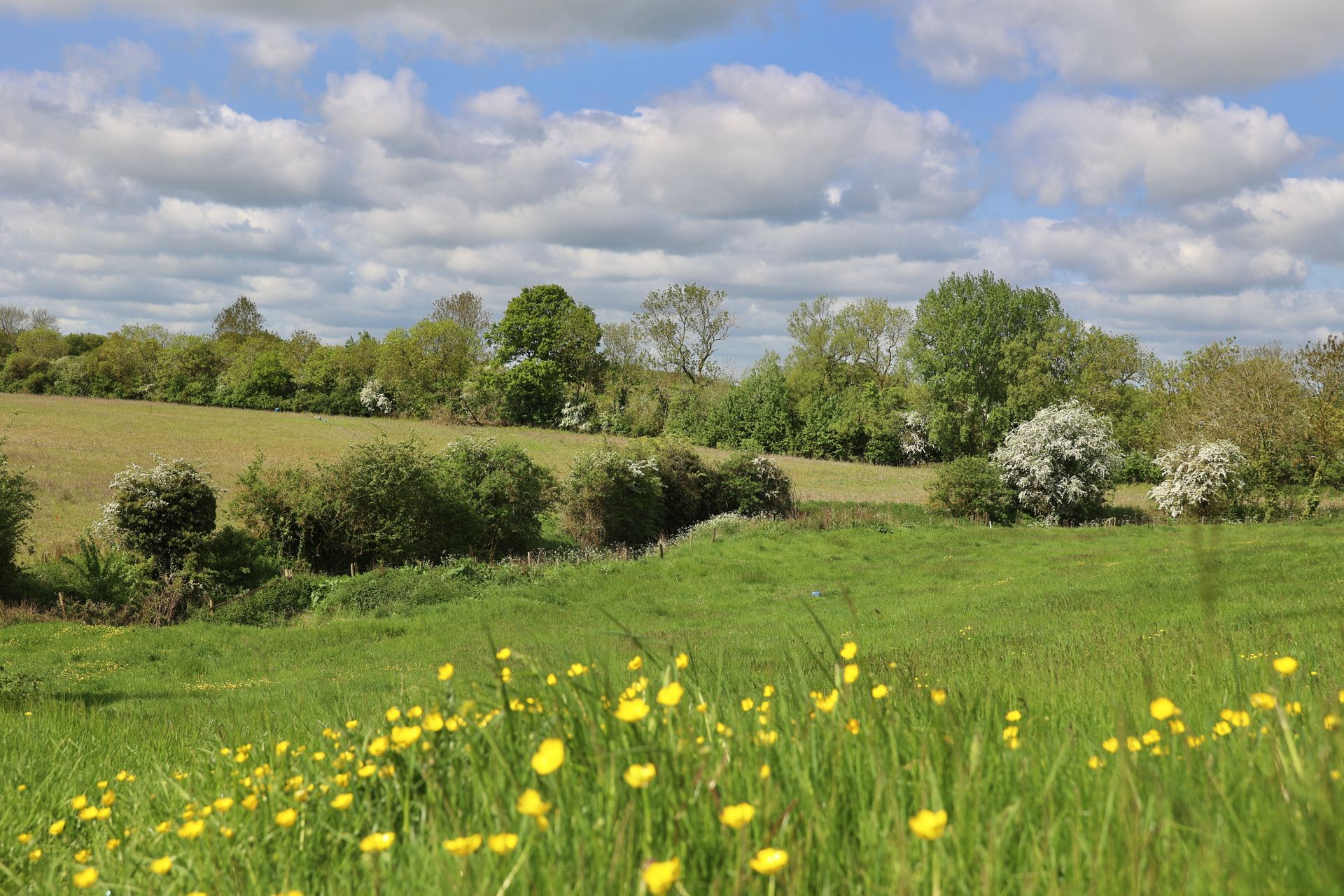
- A Country Park where there are already open fields! The existing natural environment will be disturbed to create something that is already there
- The proposed Flood Storage Area and dam to alleviate flooding would also mean waving goodbye to around 50% of the country park
- Developers propose creating a ‘wetlands’ area to solve the issue of water released from the Flood Storage Area directly above, which may also contain pollutants. Calling this a 'Country Park' is a misleading and outrageous name for a flood mitigation scheme
- The wetlands area lies above the River Great Ouse, so may well affect flooding in the area
- Attenuation ponds’ will be used all year round and reach capacity at times of flood, The Environment Agency have unanswered questions on the capacity of the ponds and their ability to retain the water
- There is no parking for the Country Park and limited access, which would increase parking on Old Stratford roads
- There is no long term plan for who will manage the park in perpetuity
- The heritage assessment is flawed as the developer has only assessed half the site for heritage impacts - the effects of engineered works in the 48 acres of Country Park are down-played and distances between major heritage assets and the site are incorrect.
- The Grand Union Canal Conservation Area would lose its rural, tranquil character, with warehousing, car parks, lighting, and major landscaping works altering both setting and views. The developer’s own assessment concurs there would be a significant negative effect on this asset.
- Significant archaeological remains would be destroyed or buried, with important sites omitted or under‑assessed by the developer, and the mitigation plan for one site has been made worthless by the developers changing their flood alleviation plans.
- Effects on key heritage assets and Scheduled Monuments are understated; they are closer and more visible to the site than claimed, with the developer’s assessment containing major factual errors that down‑play the impact. Independent analysis shows the development would be clearly visible, harming the assets’ setting, significance, and the wider historic landscape.
- The proposal conflicts with WNC Joint Core Strategy and national heritage policy requirements- It fails to protect and conserve the natural environment or built heritage, overlooks assets such as the Iron Trunk Aqueduct and downplays impacts across the board.
- There are still no small or medium-sized buildings to encourage mixed employment opportunities, as requested in the original Local Plan
- Developer’s own employment claims are exaggerated by about 27%
- Warehouse employment is in crisis with some of the highest numbers of vacancies ever seen. The work is unskilled, poorly paid and insecure
- Investment in robots means warehouses can hold more products and process them faster than if relying on humans
- Uncertain these warehouses will be let, given the number of empty ones in this region
- There is no need to build on Furtho Pit which will have traffic, flood and environmental issues when space is available 8 kilometres away with better motorway access
Writing your objection letter
It is essential that you use your own wording as much as possible when writing your objection letter. We are not providing a letter template for objections as we have been advised that duplicate letters will only be counted as one letter. For more advice on writing your letter, click on the link below:
Further action - "What more can I do?"
You can also write to your local Councillors, Planning Committee members and local MP with your concerns. Every letter will make a difference. Click on the link below for more information and list of contacts:
“There is a need for limited development in the rural area but aims to ensure that the scale of this development is consistent with the objective of meeting local needs and supporting local services.”
West Northants Council Local Plan Part 1