Heritage and Archaeology
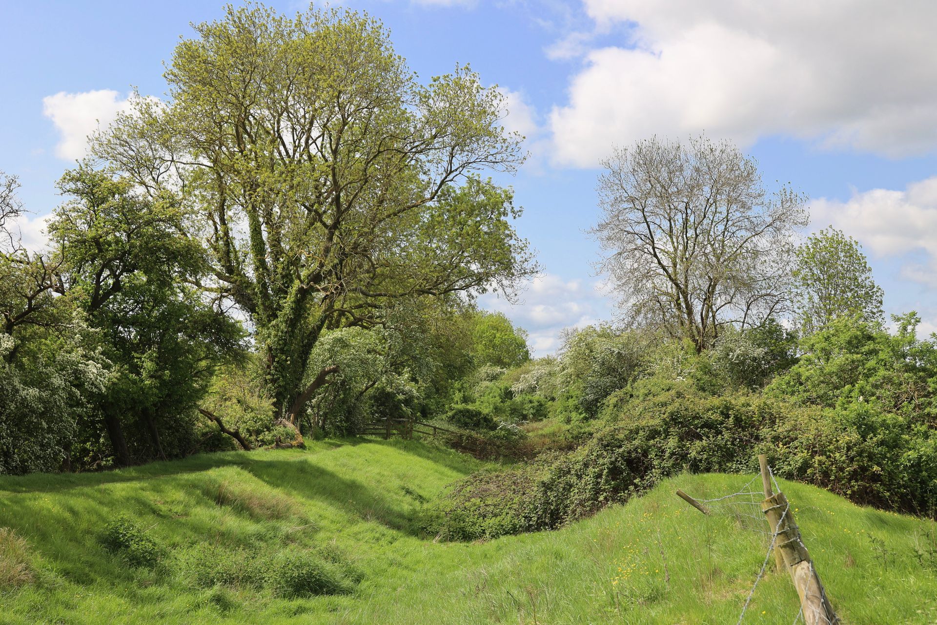
The site sits within a rural and historic agricultural landscape (not urban, as the developers claim) containing multiple heritage and archaeological features, all of which would be directly impacted by large‑scale development.
The site lies between Old Stratford, Cosgrove, and the historic town of Stony Stratford - each a designated conservation area whose character could be harmed by the introduction of a large warehouse complex nearby.
Our independent Heritage consultant, Dr Richard Hoggett, pointed out that a number of sites had been over-looked or under-valued in the developer’s Heritage Statement, and that the development would cause harm to the setting of these heritage assets.
Significantly, he noted that heritage assessment is fundamentally flawed as the developer has only assessed half the site for heritage impacts - the warehouses, but not the 48 acres of Country Park or the big engineered works within, including earthworks, flood mitigation modifications and landscaping. This eastern area is part of the application, but the heritage assessment simply ignores it, and
distances between major heritage assets and the site are incorrect.
What will be affected – and how?
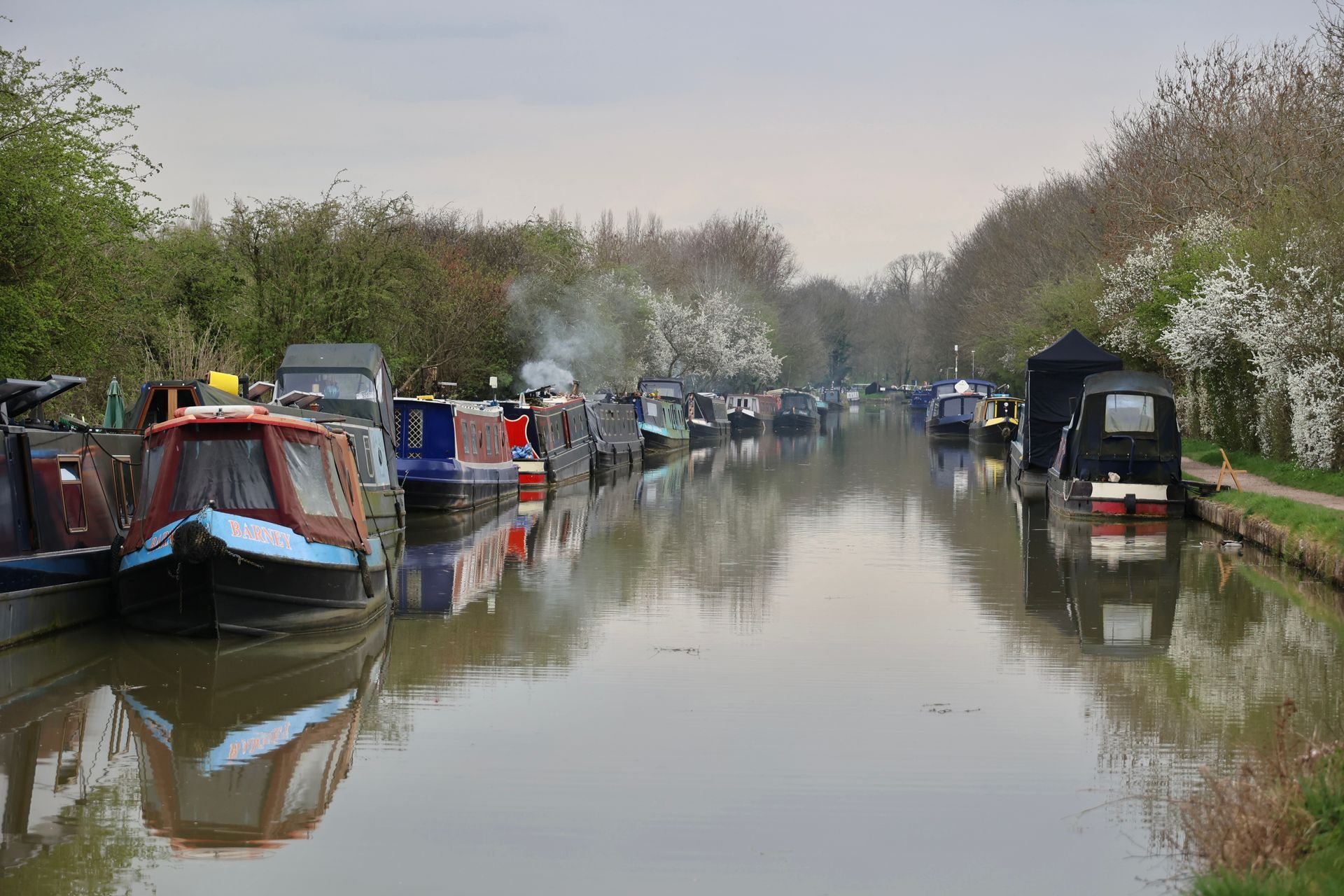
Grand Union Canal Conservation Area
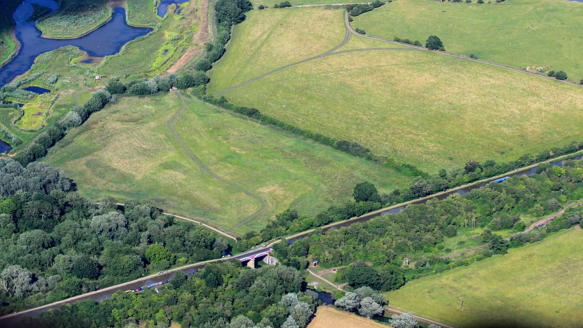
This conservation area runs through the site between the employment zone and the proposed country park. This arm of the Canal is currently being restored and re-watered and the former tow-path is a well-loved local walk in a tranquil environment. The development will significantly affect the Conservation Area, changing the land character from open fields and hedgerows to B8 warehousing and car parks, with unit 4 towering over the canal earthworks. The developers acknowledge this will result in a moderate adverse impact.
WNC’s own Senior Conservation Officer states
“The rural setting is integral to the significance / character of the canal, where any development in and around it will detrimentally alter these qualities and attributes.”
In his review, Dr Richard Hoggett noted that the developer's assessment of heritage impact on the remains of the Grand Union Canal only considers the impact of the proposed warehousing to the west and not the effect of the extensive landscaping to the east. He concludes that this change in character from agricultural land to designed and managed landscape
“will result in harm to the setting and therefore the significance of the Conservation Area in this location.”
Similarly, there is no mention in the assessment of the current heritage restoration works to the canal, and how these may be impacted.
Following the latest planning submissions, the Canal and River Trust raised concerns about the canal embankment's strength, exacerbated by the revisions to flooding mitigation proposals.
Archaeology
Iron Age/Roman remains within the site will be removed during construction, potentially resulting in their complete loss. The Council's Archaeological Adviser has mandated a programme of archaeological work, but compliance with this request is unclear. The Roman Villa, significant and less than 1km from the development site, is omitted from the Developer’s assessment. Early Medieval remains in the proposed Country Park will be buried under a landscaped bund, potentially affecting their archaeological significance.
Heritage Sites
The National Planning Policy Framework (NPPF) requires applicants to describe the significance of any affected heritage assets. The developers recognise two significant sites near the development: Old Wolverton Mill and the Motte and Bailey Castle. However, they have not considered the Cosgrove Aqueduct, despite it being on Historic England’s Scheduled Monument list. The developers' assessment downplays the visibility and impact on these heritage sites, which is contested by the community.
Scheduled Monument of Motte and Bailey Castle, Deserted Village and Monastic Grange at Old Wolverton
Dr Richard Hoggett states that the Scheduled Monument is significant as a complete and well-preserved medieval landscape with an unusual range of features. The proposed site forms part of this historic agricultural setting, evidenced by surviving ridge-and-furrow earthworks from mediaeval ploughing.
Although the developer acknowledges the monument’s importance, the heritage assessment wrongly claims nearby Scheduled Monuments are not inter-visible and that their settings will be unaffected. Dr Hoggett disputes this, noting the monument’s elevated position and the proposed building heights would make the development clearly visible. The developer’s own Zone of Theoretical Visibility shows the entire monument within the visibility area. He again identifies factual errors: the assessment ignores land east of the Grand Union Canal and incorrectly states the monument is 2km away, when it is about 850m at its closest.
Dr Hoggett concludes that the Environmental Statement’s conclusions on visibility and the contribution of the site’s agricultural land are based on flawed assumptions and are unreliable.
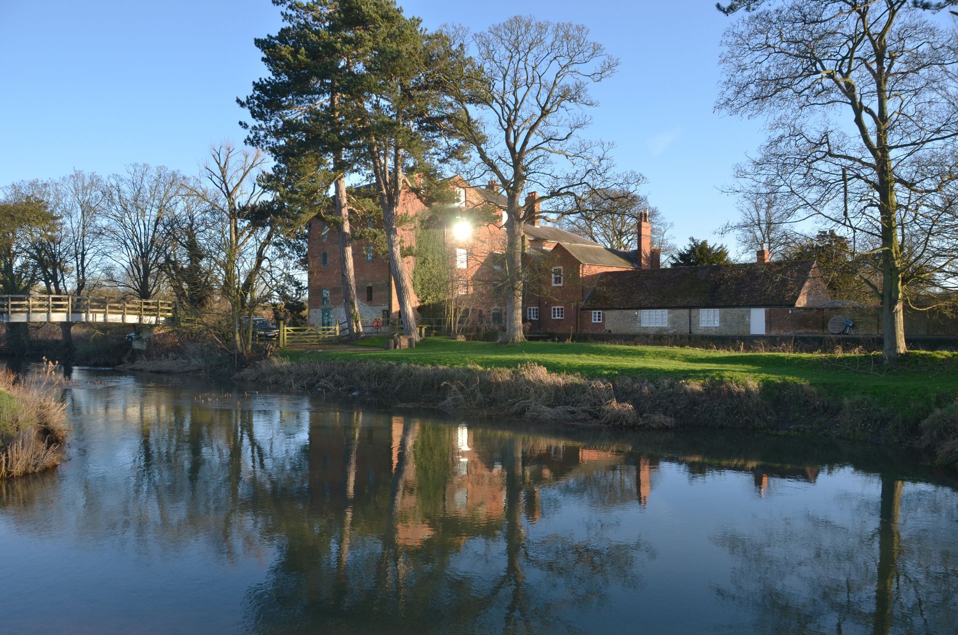
Wolverton Mill Complex
Wolverton Mill is a Domesday-era mill on the River Great Ouse, with buildings dating from the late 18th and early 19th centuries. It is Grade II listed and set in the entirely rural setting of Ouse Valley Park, where its riverine and open agricultural surroundings contribute to its significance.
The developer’s heritage assessment dismisses the mill, claiming it is not visible and lies 1.35km away. Dr Hoggett disputes this, noting the distance is incorrect because only land west of the canal was considered; the eastern edge of the site is in fact just 500m away.
The mill falls within the Zone of Theoretical Visibility. Dr Hoggett argues that, due to its height, much of the development would be visible—particularly the eastern area by day and more extensively at night because of floodlighting. He also raises concerns about noise affecting its tranquil setting and potential harm from increased river levels due to surface run-off and increased risk posed by the Flood Storage Area.
Dr Hoggett’s report concludes that the proposed development substantially impacts heritage and archaeology sites and does not comply with relevant legislation and policies, highlighting the need to preserve the historical and cultural significance of the area.
For further details, please refer to the full review of the Heritage Assessment which can be downloaded here.
“Where harm would be caused, including through development proposals outside of a conservation area which have an adverse effect on the setting of the conservation area or any views into or out of the area, such harm will need to be weighed against the public benefits of the proposals”
South Northamptonshire Part 2 Local Plan 2011-2029
The Buckingham Arm of the Old Canal, a conservation area, will be overshadowed by warehouses immediately beside it
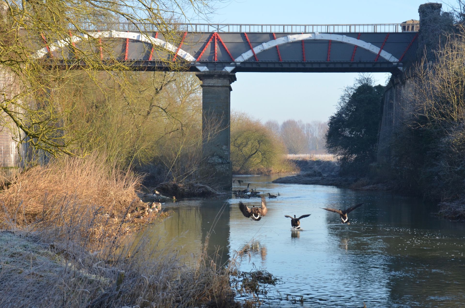
The Iron Trunk Aqueduct, a nineteeth century scheduled monument 1.2 km from the site, has clear views across the valley to the site, but was completely ignored in the developers heritage statement.
“Development that would harm locally important archaeological remains or their settings will only be permitted where the public benefits of that development are significant and can be demonstrated to outweigh the harm to the archaeological interest of the asset and its setting”
South Northamptonshire Part 2 Local Plan 2011-2029
Heritage and Archaeology - Reasons to Object
- The heritage assessment is flawed as the developer has only assessed half the site for heritage impacts - the effects of engineered works in the 48 acres of Country Park are down-played and distances between major heritage assets and the site are incorrect.
- The Grand Union Canal Conservation Area would lose its rural, tranquil character, with warehousing, car parks, lighting, and major landscaping works altering both setting and views. The developer’s own assessment concurs there would be a significant negative effect on this asset.
- Significant archaeological remains would be destroyed or buried, with important sites omitted or under‑assessed by the developer, and the mitigation plan for one site has been made worthless by the developers changing their flood alleviation plans.
- Effects on key heritage assets and Scheduled Monuments are understated; they are closer and more visible to the site than claimed, with the developer’s assessment containing major factual errors that down‑play the impact. Independent analysis shows the development would be clearly visible, harming the assets’ setting, significance, and the wider historic landscape.
- The proposal conflicts with WNC Joint Core Strategy and national heritage policy requirements- It fails to protect and conserve the natural environment or built heritage, overlooks assets such as the Iron Trunk Aqueduct and downplays impacts across the board.
